

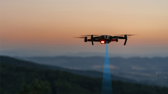
UAV
LiDAR Sensors for Drones or UAVs
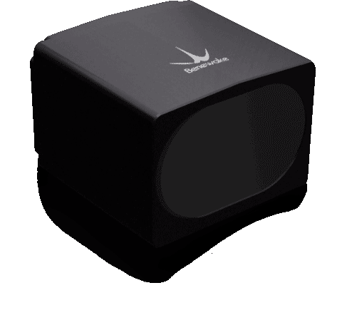
TF03 is designed for UAV altitude hold and terrain-following missions that need long-range, high-rate distance input. Integrate it with verified power, interface, and mounting conditions, and validate target reflectivity, ambient light, and vehicle attitude before release.


Key specifications
Need help confirming a selection or purchase details?
| Parameter | Value | Parameter | Value |
|---|---|---|---|
| Measuring range | 0.1 ~ 180 m | Detecting accuracy | ± 10 cm (≤ 10 m)1% (> 10 m) |
| Frame rate | 1 ~ 9800 Hz | Interface | UART, CAN, RS-232, RS-485 |
| Protection | IP67 | Dimensions | 44 mm × 43 mm × 32 mm |
| Power consumption | ≤ 0.8 W | Weight | 86 ± 3 g |
| Field of view | 0.5° | Output data | Single-point Distance Value |
| Operating voltage | 5 ~ 24 V |
Suitable for UAV altitude hold, terrain following and flight platforms requiring fast distance updates.
Condition: Bounded by the range, accuracy and operating conditions in the product datasheet.
TF03 is not intended for measurements beyond this model's datasheet range, accuracy or interface limits, and is not a substitute for certified redundant safety systems.
Condition: If the target requirement exceeds the specification boundary, complete a selection review or contact technical support first.
Set the working distance and margin for the real target reflectivity first, then compare weight, enclosure, protection, interface and update rate. These are current specification differences, not a performance ranking without matched-condition tests.
View comparison topicTFA170-L is currently specified at 0.1–170 m, about 10 g, RS-232 and 12 V for systems that need long-range input while tightly controlling payload.
Boundary: It has no enclosure; verify output rate and delivered version, and validate structural, water and thermal protection for outdoor use.
View model detailsTF03 is currently specified at 0.1–180 m and IP67 with UART, CAN, RS-232 and RS-485 for outdoor tasks that can carry about 86 g and need enclosure and interface choice.
Boundary: High rates must match baud rate and interface version; target surface, background, vibration and control latency still require system validation.
View model detailsTFA300 is currently specified at 0.1–290 m, up to 10000 Hz and IP67 with UART and CAN for tasks where long range and fast sampling both matter.
Boundary: Headline maxima do not replace tests with the real target and environment; verify power, data-link bandwidth, mounting stiffness and version together.
View model detailsTF350 is currently specified at 0.2–350 m and IP67 with UART, CAN, RS-232 and RS-485 for platforms prioritizing range margin and interface choice and able to carry about 224 g.
Boundary: Greater range comes with more weight and size; do not select by maximum range alone—validate target, environment, mounting and system stopping or control margin.
View model details| Parameter | TFA170-L | TF03 | TFA300 Series | TF350 |
|---|---|---|---|---|
| Measuring range | 0.1 ~ 170 m | 0.1 ~ 180 m | 0.1 ~ 290 m | 0.2 ~ 350 m |
| Detecting accuracy | ± 10 cm (< 10 m), 1% (≥ 10 m) | ± 10 cm (≤ 10 m)1% (> 10 m) | ± 10 cm (<10 m)1% (≥ 10 m) | ± 10 cm (≤ 10 m)1% (> 10 m) |
| Frame rate | 1 ~ 1000 Hz | 1 ~ 9800 Hz | 1 ~ 10,000 Hz | 1 ~ 1000 Hz |
| Interface | RS-232 | UART, CAN, RS-232, RS-485 | UART, CAN | UART, CAN, RS-232, RS-485 |
| Protection | Without enclosure | IP67 | IP67 | IP67 |
| Dimensions | 31.0 mm × 30.2 mm × 19.2 mm | 44 mm × 43 mm × 32 mm | 49.4 mm × 37.0 mm × 28.6 mm | 78 mm × 67 mm × 40 mm |
| Power consumption | ≤ 1 W | ≤ 0.8 W | ≤ 0.45 W | ≤ 1 W |
| Weight | ~ 10 g | 86 ± 3 g | 10.5 g | 224 ± 3 g |
| Field of view | < 0.5° | 0.5° | < 0.5° | 0.35° |
| Operating voltage | DC 12 ± 10% V | 5 ~ 24 V | DC 5 V ± 10% | 5 ~ 24 V |
5 platforms with 8 installation, configuration and code resources.
Setup, connection, configuration and code guidance for TF03 with ArduPilot. The original files are available in Materials and downloads. Documented interface: CAN, I²C, UART / TTL, UART.
CAN, I²C, UART / TTL, UART · 2026-08-31View integration resource →ArduPilotSetup, connection, configuration and code guidance for TF03 with ArduPilot. The original files are available in Materials and downloads. Documented interface: CAN, UART.
CAN, UART · 2026-08-31View integration resource →ArduPilotSetup, connection, configuration and code guidance for TF03 with ArduPilot. The original files are available in Materials and downloads. Documented interface: UART, CAN.
UART, CAN · 2026-08-31View integration resource →Setup, connection, configuration and code guidance for TF03 with Raspberry Pi. The original files are available in Materials and downloads. Documented interface: CAN, RS485 / Modbus, UART / TTL, UART, I/O.
CAN, RS485 / Modbus, UART / TTL, UART, I/O · 2026-08-31View integration resource →Raspberry PiSetup, connection, configuration and code guidance for TF03 with Raspberry Pi. The original files are available in Materials and downloads. Documented interface: CAN, RS485 / Modbus, UART, I/O.
CAN, RS485 / Modbus, UART, I/O · 2026-08-31View integration resource →The TF03 offers two variants: TF03-100 with 100 m @ 90% reflectivity and 40 m @ 10% reflectivity, and TF03-180 with 180 m @ 90% reflectivity and 70 m @ 10% reflectivity. Both models have a blind zone of ≤ 0.1 m, meaning they cannot measure targets closer than 10 cm.
The TF03 supports three independent hardware interface options: UART/CAN (switchable by command), RS232, and RS485. Users must select the corresponding product model based on their system requirements. All interfaces use 3.3 V TTL logical voltage.
The TF03 is designed for industrial high-speed measurement applications including robotics distance sensing, autonomous vehicle obstacle detection, aerial platforms altitude measurement, port automation, mining operations, and IoT distance monitoring. Its configurable frame rate (up to 9,800 Hz) and outdoor rain/snow/fog compensation algorithms make it suitable for demanding outdoor industrial environments.
The TF03 delivers ±10 cm accuracy within 10 meters and ±1% accuracy beyond 10 meters, with repeatability < 3 cm @ 1σ. Distance resolution is 1 cm, and measurements are certified under indoor conditions with a 90% reflectivity diffuse whiteboard target at 25°C.
The TF03 operates from -25°C to +60°C and features IP67 protection, making it suitable for outdoor deployment in variable weather. Storage temperature range is -40°C to +85°C. The integrated compensation algorithms enable normal operation in strong sunlight, rain, snow, and fog environments with ambient light resistance up to 100 KLux.
The TF03 accepts DC 5V ~ 24V power input with average power consumption ≤ 800 mW and peak current < 480 mA @ 12V. This wide voltage range supports integration with battery-powered UAVs, portable robotics, and industrial control systems without additional voltage regulation.
The TF03 measures 44.0 mm × 43.0 mm × 32.0 mm with a typical weight of 86 ± 3 g (excluding cable). The 70 cm cable length and compact form factor enable integration into space-constrained platforms such as micro-UAVs, AGVs, and handheld measurement devices.
The TF03 is not suitable for: (1) applications requiring < 0.1 m measurement due to its blind zone; (2) high-precision scanning requiring sub-centimeter accuracy beyond 10 meters (±1% error accumulates); (3) rotating panoramic scanning (use multi-beam LiDAR instead); (4) extreme temperature environments outside -25°C ~ +60°C; (5) completely sealed enclosures where ventilation cannot accommodate the cable connector. Reflectivity requirements also matter—performance degrades significantly on low-reflectance (< 10%) targets at maximum range.
The TF03-180 achieves 180 m max range versus LidarLite V3's 40 m, giving Benewake a 4.5× range advantage for long-distance industrial applications. However, TF03's ±1% error at distance (vs. LidarLite's reported ±2.5 cm fixed error) makes it more suitable for applications where relative accuracy matters. The TF03's IP67 rating and built-in rain/fog compensation also provide superior outdoor durability compared to typical consumer-grade rangefinders.
The TF03 supports standard industrial communication protocols (UART, RS232, RS485, CAN) enabling integration with Pixhawk autopilots, ROS-based robotics platforms, PLC control systems, and Arduino/embedded Linux boards. The configurable frame rate (1–9,800 Hz default 100 Hz) and compact Molex 7-pin connector (MH1.25-7P-W/B) facilitate OEM integration into UAVs, AGVs, port automation systems, and IoT monitoring devices. Class1 eye-safety certification (IEC 60825-1:2014) also permits deployment in human-occupied environments.
Confirm the model-specific protocol, baud rate, and interface first. A baud rate that is too low for the configured frame rate can overflow the transmit buffer. TF03 TTL/RS485/CAN commands must not be mixed with the Modbus commands for TFmini-i-485 or TF02-I-485; use the model manual.
To switch UART to CAN, send 5A 05 45 02 A6 and then 5A 04 11 6F to save. To switch CAN to UART, send 5A 05 45 01 A5 over the CAN bus and save. Reconnect using the new interface and the 250 kbps CAN configuration.
Send the new baud-rate value using the TF03 command format. Disconnect and reconnect at the new baud rate before saving; do not raise the frame rate while the sensor is still running at a baud rate that is too low.
The transmit buffer may have overflowed. Use a Benewake offline downloader with the matching bin firmware and align its probes to the four-pin debug interface using the PCB GND mark. Get support guidance before doing this; in future, raise the baud rate and reconnect before raising the frame rate.
A nearby infrared source, such as a security camera illuminator, is a common cause. Capture 9-byte raw data including strength, temporarily disable or shield the suspected source, then add shielding, relocate the sensor, or revise the installation.
Check TX/RX, power, and common ground first. With ArduPilot, confirm RNGFND1_TYPE=20 and RNGFND1_ADDR=0x10 for I2C. Validate the hardware with ArduPilot before investigating PX4 driver compatibility; TF03 CAN also needs 250 kbps and 120Ω termination at both ends.
Use an RS485-to-TCP DTU as a bridge: connect TF03 to the DTU over RS485, configure the target socket and cloud device, and forward data over cellular or Wi-Fi. Confirm the Modbus/protocol, power, network, and data-security settings for the deployment.
TF03
TF03
TF03