
Applicable scenarios
Suitable for 360° single-line pool-wall scanning, mapping, localization and obstacle avoidance on cleaning robots.
Condition: Bounded by the range, accuracy and operating conditions in the product datasheet.
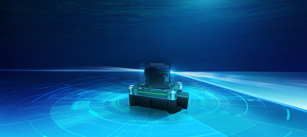
By performing distance measurements of the pool walls through 360° scanning at 6 times per second, VLS-H5 acquires high-precision point cloud data. When combined with SLAM technology, this data enables robots and other devices to quickly capture the contour of the operating area, supporting mapping, localization, and obstacle avoidance.
Key specifications
Need help confirming a selection or purchase details?
| Parameter | Value | Parameter | Value |
|---|---|---|---|
| Measuring range | 5 m | Detecting accuracy | < 3 cm @ (0.1 ~ 2 m, 10% reflectivity, 0 KLux, < 0.5 NTU) |
| Frame rate | 6 Hz | Interface | UART |
| Protection | IPX8 | Dimensions | 52.0 mm × 75.0 mm × 53.1 mm |
| Weight | 125g | Field of view | 360° |
| Output data | 3.3 V TTL | Operating voltage | DC 5.4 V ± 5% |
Suitable for 360° single-line pool-wall scanning, mapping, localization and obstacle avoidance on cleaning robots.
Condition: Bounded by the range, accuracy and operating conditions in the product datasheet.
VLS-H5 is not intended for measurements beyond this model's datasheet range, accuracy or interface limits, and is not a substitute for certified redundant safety systems.
Condition: If the target requirement exceeds the specification boundary, complete a selection review or contact technical support first.
The VLS-H5 achieves a maximum detection range of 5 meters at 30% reflectivity under 0 KLux ambient light and water turbidity below 0.5 NTU. The blind zone is ≤ 0.1 m, meaning it can detect objects as close as 100 mm from the sensor. This makes it suitable for close-range underwater scanning and obstacle detection applications.
The VLS-H5 communicates exclusively via UART (serial interface) at 230400 baud rate with 3.3 V TTL output levels. The sensor uses an M14-4P aviation-style connector (female head, gold-plated punch pins) with a 350 ± 20 mm cable. This standard serial interface is compatible with most embedded systems, microcontrollers, and edge computing platforms.
The VLS-H5 is specifically optimized for underwater SLAM (Simultaneous Localization and Mapping), autonomous underwater vehicle (AUV) navigation, and underwater positioning applications. Its 360° scanning capability, dedicated underwater algorithm, and IPX8 waterproof rating at 4m depth make it ideal for subsea mapping, obstacle avoidance, and environmental surveys in freshwater and lightly turbid waters.
The VLS-H5 delivers absolute accuracy of < 3 cm (single measurement) and repeatability accuracy of < 2 cm (1σ standard deviation) when measuring targets at 0.1–2 m distance with 10% reflectivity and minimal ambient light. Range resolution is 1 mm, enabling fine-grained distance discrimination. These tight tolerances ensure reliable positional data for SLAM and mapping algorithms.
The VLS-H5 operates safely between 0°C and +50°C, with storage range of −20°C to +70°C. It carries an IPX8 waterproof rating certified for continuous operation at depths up to 4 meters, making it fully submersible. This environmental hardness suits long-duration underwater missions and extreme outdoor conditions.
The VLS-H5 requires a regulated DC 5.4 V ± 5% power supply, with average current consumption of < 450 mA and peak current of < 750 mA. Total average power budget is approximately 2.4 W, making it suitable for battery-powered autonomous platforms and compact embedded systems. Power delivery is via the M14-4P connector.
The VLS-H5 measures 52.0 mm × 75.0 mm × 53.1 mm (excluding the 350 mm cable), resulting in a compact hexagonal form factor optimized for AUV integration. The sensor features an aviation-grade M14-4P connector for environmental sealing. The small footprint and integrated mechanical rotation system make it ideal for payload-constrained underwater platforms.
The VLS-H5 is designed exclusively for underwater/aquatic environments and is not suitable for above-water autonomous driving (ADAS), drone altitude hold, or high-speed robotics applications. Its 6 Hz scan rate (5 m max range) is insufficient for vehicle safety systems requiring > 100 Hz refresh rates. It is also not rated for saltwater (marine) environments where higher corrosion protection is needed, and performance degrades significantly in highly turbid water (> 0.5 NTU).
Unlike Lightware's LW series (which are single-point rangefinders), the VLS-H5 is a 360° scanning LiDAR with integrated mechanical rotation, enabling full 2D environmental mapping in a single device. At 5 m range and < 3 cm accuracy, the VLS-H5 offers comparable distance performance to Lightware's optical rangefinders but with 360° field-of-view coverage. The trade-off is that it requires higher power consumption (2.4 W vs. < 0.5 W for point sensors) and is mechanically more complex.
The VLS-H5's UART/TTL interface is compatible with any system supporting serial communication: microcontroller boards (Arduino, STM32, Raspberry Pi via USB-to-serial adapters), embedded Linux systems, single-board computers, and PLC devices. Being a hardware serial interface, no special driver is required—only serial port parsing firmware. Integration with ROS and autonomous platform software depends on end-user middleware implementation.
Air testing is possible, but underwater calibration does not represent air accuracy and errors of about 5–10 cm may occur. For an air POC, recalibrate for air and remove underwater refractive-index and angular-refraction compensation from the SDK.
Verify stable 5.4V±5% power. Use Benewake PC software to observe the raw output and separate sensor-side issues from application-side issues, then check whether ROS or driver logic is filtering valid points.